Description
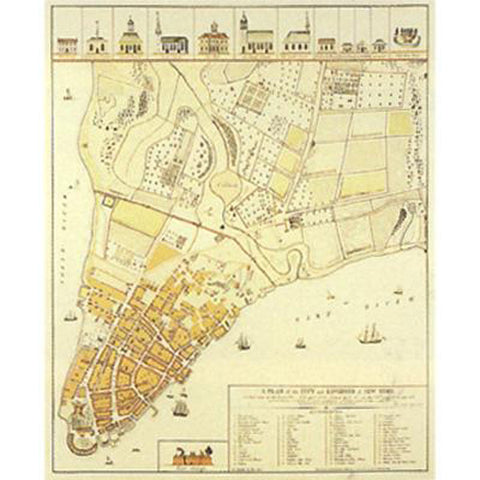
A Plan of the City and Environs of New-York as they were in the Years 1742, 1743 & 1744. Drawn by D…G… in the 76th year of his age who had at this time a perfect and correct recollection of every part of the same. (1813)
A native of Bavaria, David Grim (1737-1826) came to New York with his parents while still an infant. From 1767 to 1789 he was the proprietor of the popular Hessians Coffee House, first on Chapel Street, and then on William Street. The location of Grim's Coffee House presented him with a unique vantage point to observe and document the City as it grew from a rural small-town to a bustling urban center of trade. This map represents mid-eighteenth century New York City as Grim recalled it in 1813, at the age of 76.
In the line of the buildings at the top of the map you can read the religious and cultural diversity of New York, from Lutheran church to Quaker meetinghouse to synagogue. Also located within the cluster of buildings are a poorhouse and the Half Moon Battery, the city's garrison of defense. "The Great Negro Plot" of 1741, in which enslaved Africans allegedly conspired to overthrow the city government, is memorialized through the depiction of the gallows and the "conspirator" being gibbeted there.
Dimensions: 23.75" x 19"
Item Number:
1162


